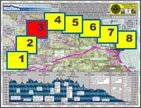
| Start point: |
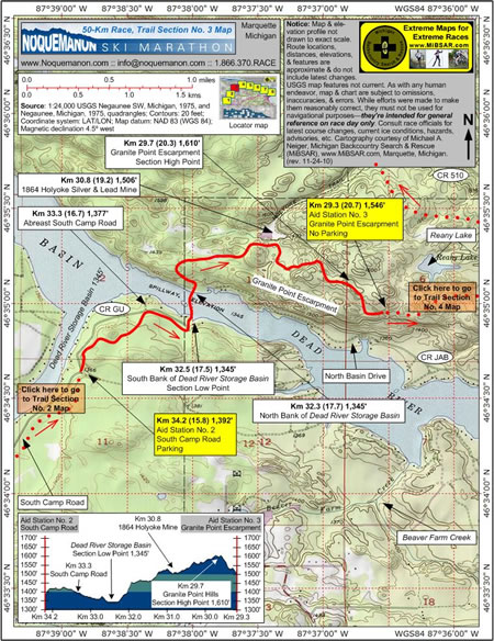
Km 34.2 (15.8)—Aid Station
No. 2, South Camp Road, 1,392 feet |
| End point: |
Km 29.3 (20.7)—Aid Station
No. 3, Granite Point Escarpment, 1,546 feet |
| Length: |
4.9 km |
|
Elevation Data
|
| Ascending: |
+335 feet |
| Descending: |
-181 feet |
| Change: |
+154 feet |
| Minimum: |
1,345 feet |
| Maximum: |
1,610 feet |
|
Description
 Aid
Station No. 2 (South Camp Road) at Km 34.2 (15.8,
1,392 feet) is located adjacent to the east side of
South Camp Road. Crewed by members of the Ishpeming
Pioneer Kiwanis Club, it has roadside parking. Aid
Station No. 2 (South Camp Road) at Km 34.2 (15.8,
1,392 feet) is located adjacent to the east side of
South Camp Road. Crewed by members of the Ishpeming
Pioneer Kiwanis Club, it has roadside parking.
From the aid station,
racers will continue skiing north until they again
come abreast of South Camp Road on trail left at Km
33.3 (16.7, 1,377 feet).
Before long, racers will drop down to
the section's lowest elevation point, the south bank
of the Dead River Storage Basin at Km 32.5 (17.5,
1,345 feet). At this point, racers will have left
Ishpeming Township and entered Negaunee Township.
After a short, 250-meter ice crossing,
racers will arrive at the north bank of the basin
at Km 32.3 (17.7, 1,345 feet).
As they make the arduous, 265-foot climb
to the section's highest elevation point atop Granite
Point Escarpment at Km 29.7 (20.3, 1, 610 feet), racers
will pass within 200 meters of the long-silent, 1864,
Holyoke Silver and Lead Mine on trail left at Km 30.8
(19.2, 1,506 feet).
The Granite Point Escarpment, with its
scenic, cliff-top view of the Noquemanon Valley as
well as its stands of old growth white and red pines,
is regarded as one of the nicest sections of the racecourse.
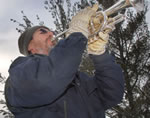 Shortly
after leaving the section's highest elevation point,
racers may well hear a wonderfully-talented bugler
in the distance. Shortly
after leaving the section's highest elevation point,
racers may well hear a wonderfully-talented bugler
in the distance.
 If
so, they'll know they're closing on Aid Station No.
3 (Granite Point Escarpment) at Km 29.3 (20.7, 1,546
feet), which is located atop the escarpment, some
200 meters north of North Camp Road. Crewed by members
of the Negaunee Lions Club, it has no available parking. If
so, they'll know they're closing on Aid Station No.
3 (Granite Point Escarpment) at Km 29.3 (20.7, 1,546
feet), which is located atop the escarpment, some
200 meters north of North Camp Road. Crewed by members
of the Negaunee Lions Club, it has no available parking.
Click
here to read about Trail Section No. 4.
|
|
|
|
Click
here or on map above for high-resolution,
1:24,000-based, USGS imagery of Trail Section No.
3
|
Notice:
The maps and elevation profile charts
are not drawn to exact scale. Route locations,
distances, elevations, features, statistics,
and descriptions are approximate, and do not
include the latest changes or reroutes. USGS
base map features are not current. As with any
human endeavor, this map and chart are subject
to omissions, inaccuracies, and errors. While
efforts were made to make them reasonably correct,
they must not be used for navigational purposes—they
are intended for general reference on race day
only. Consult race officials for the
latest course changes and reroutes as well as
current ice conditions, hazards, advisories,
etc.
Web page design, hosting,
& cartography courtesy of Michael A. Neiger
of Michigan Backcountry Search and Rescue (MiBSAR),
www.MiBSAR.com,
in Marquette, Michigan.

Michael welcomes your
comments and suggestions on how to improve the
maps, charts, and information on this Web page
at mneiger@hotmail.com.
|
|