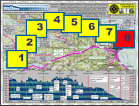
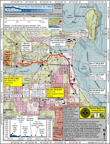
|
Description
Aid Station No. 7 (Dead River) at Km
4.3 (45.7, 644 feet) is located about 300 meters southwest
of County Road 550, the Big Bay Road. Parking is available.
From the aid station, racers quickly
climb to the section's highest elevation point at
Km 4.1 (45.9, 667 feet).
Almost immediately upon descending,
racers leave Marquette
Township to enter the City
of Marquette.
 |
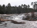 |
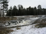
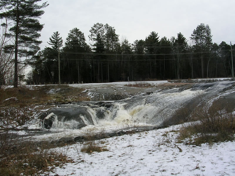
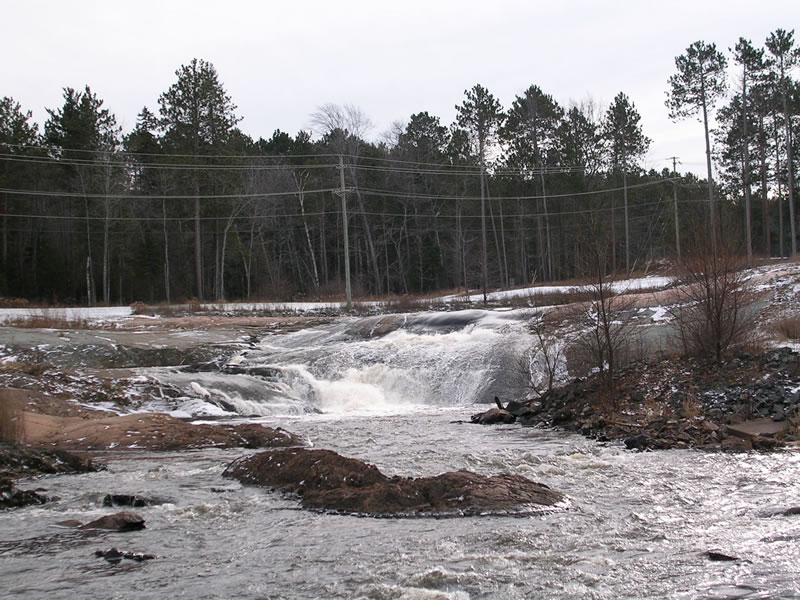
| The 30-foot Dead River Falls.
(© 2010 by Michael Neiger) |
From the city limits, racers will ski
another kilometer along the north bank of the Dead
River before coming to the 30-foot-high Dead River
Falls.
Once at the falls, they'll cross under
the new County Road 550 bridge over the Dead River
at Km 3.1 (46.9, 612 feet). The river is then crossed
via an old, abandoned highway bridge immediately adjacent
to the north side of the current bridge.
From the Dead River Bridge, racers ski
along the south bank of the Dead River until they
cross Powder Mill Road at Km 2.4 (47.6, 616 feet).
A short distance further and they emerge from the
woods onto an old abandoned railroad grade at Km 1.9
(48.1, 611 feet).
 |
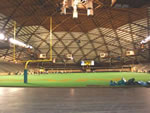 |
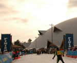
| The finish line at Northern
Michigan University's Superior Dome. Click
here to view real-time image from Dome's stadium
floor webcam. |
Skiing east along this grade, racers
will cross Schneider Mill Road at Km 1.7 (48.3, 610
feet) before crossing Hawley Street at Km 1.3 (48.7,
607 feet), the section's lowest elevation point.
Still skiing along the grade, racers
have only to cross Wright Street at Km 0.6 (49.4,
610 feet) before arriving at the Noquemanon's finish
line at Northern Michigan University's Superior
Dome at Km 0.0 (50.0, 610 feet).
Built in 1991, the 14-story, 16,000-person-capacity,
dome encloses 5.1 acres and houses, among other things,
the United States Olympic Education Center (USOEC).
Click
here to return to the Map Index.
|

