|
"In the school
of the wilderness," Horace Kephart said, "there
is no graduation day." To that I would add, "but
the classes are always fascinating, sometimes exciting, and
the homework is extensive."
Every trip to the wilderness is like a
class. You learn from observation, from experience, from introspection,
and from the friends who are out there with you. Between 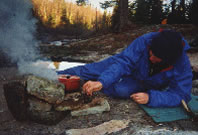 "classes,"
you do the homework: finding answers to the questions posed
by the last trip and preparing for the next one. In my case,
this early May "class" had some difficult lessons. "classes,"
you do the homework: finding answers to the questions posed
by the last trip and preparing for the next one. In my case,
this early May "class" had some difficult lessons.
Mike U. "boils up" just as the
sun rises over the Yellow Dog River (Photo by Mary Powell)
The McCormick Tract is a 17,000-acre wilderness
area in Michigan's Upper Peninsula. It sits astride Marquette
and Baraga counties, west of the village of Big Bay. It is
comprised of rocky bluffs and irregular hills left by receding
glaciers. 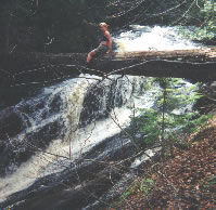 The
Yellow Dog River runs through it, dropping sharply enough
in places to create falls. There are numerous small lakes
and wetlands. Last logged around 1910, the tract has some
stands of sizable old timber. Hardwoods, pines, and hemlocks
give way to cedars and other swamp plants in the lowest areas. The
Yellow Dog River runs through it, dropping sharply enough
in places to create falls. There are numerous small lakes
and wetlands. Last logged around 1910, the tract has some
stands of sizable old timber. Hardwoods, pines, and hemlocks
give way to cedars and other swamp plants in the lowest areas.
Mary checks out the view of the North Falls
on the West Branch of the Yellow Dog River (Photo by Mary
Powell)
The land was owned for three generations
by descendents of Cyrus McCormick, inventor of the reaper.
After infrequent use as a retreat, it was bequeathed to the
U.S. Forest Service in 1969 by the last of his heirs. My trip
from Flint to the rendezvous point was a bit roundabout as
I first dropped my mother off to visit her sister in Iron
Mountain. From there, I drove north on M-95, east across US-41,
through Marquette, and then northwest on CR 550 before arriving
in Big Bay. The countryside along much of this route was very
scenic and I had to resist a strong temptation to explore
some inviting spots along the way, like the banks of the Michigamme
River and Marquette's Presque Isle Park.
Upon arrival in Big Bay, I set up camp
in Perkins Park near where we were to assemble the following
morning. Mike U., another member of our group, showed up as
I was getting organized. We decided to have dinner at the
Lumberjack Bar. We then explored the harbor area and went
up to the lighthouse to check out the carpet of wildflowers
there. Neither of us could identify the small, pink-striped
white flowers that covered the woodland floor and filled the
air with their perfume. Fortunately, another member of our
group, Gail, was exploring the area with her son. She thought
the flowers were "spring beauty," an ID later confirmed
with a wildflower text.
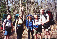
Thursday morning, the entire group assembled
at the Big Bay Cafe. Besides Mike, Gail and myself, there
was Jane, a newcomer to the group, and Michael, the trip leader.
After a pancake breakfast, we loaded our packs into the two
vehicles best equipped to handle back roads and headed out.
The county had done considerable work in the previous week
as Michael said some places had been nearly impassable due
to flooding, fallen trees, and snow pack a few days earlier.
After spotting one vehicle near the northwest
corner of the tract, we parked the other near a trailhead
a few miles away. We weighed our packs, admitted to excess,
and pared them down as much as possible. While we were getting
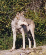
organized a couple of coyotes ran toward us from the woods,
then veered off suddenly to the edge of the clearing, visibly
startled by our presence.
We began our hike following a trail that
would intercept the Yellow Dog River below the falls, the
plan being to work our way up river from there. Getting to
the first falls was a relaxing walk and we spent the balance
of the 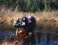 warm,
sunny morning and early afternoon climbing upward. We discovered
a succession of picturesque falls, played in the river at
quieter spots, took pictures, listened to the roar of water
over rock, and contemplated its power. warm,
sunny morning and early afternoon climbing upward. We discovered
a succession of picturesque falls, played in the river at
quieter spots, took pictures, listened to the roar of water
over rock, and contemplated its power.
Mary fords a deep hole in the Yellow Dog
River (Photo by Mary Powell)
Then, turning away from the river, we climbed
an impressive knob of rock called the Crow's Nest. At the
top, we ate lunch, enjoying awesome vistas in all directions.
Lake Superior was visible more than twenty miles away. The
hardwoods were just beginning to show signs of spring: maples
had a haze of red flower buds and poplars were covered with
new, chartreuse-colored leaves. These were interspersed with
the contrasting dark green of pines.
After lunch, we worked our way farther
up the river, eventually deciding to camp on a bluff overlooking
a wetland. The evening was punctuated by intermittent light
showers. We explored the area, talked, and read before turning
in. Awakening during the night, an almost full moon lit the
marsh, creating a stark contrast with 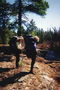 the
dark forest beyond. the
dark forest beyond.
The next morning we again followed the
river, finding old hiking trails and remnants of bridges.
By lunchtime, we had found another falls roaring through a
clearing and we settled there to eat. The plan was to bushwhack
to a proposed campsite on Lake Margaret after the meal. Following
lunch and some relaxation, we packed up, skirted a small marsh,
and set out on our calculated bearing.
Gail and Jane prepare to ford the Yellow
Dog River at Splint Rapids (Photo by Mary Powell)
A little over 300 yards into this trek,
with my eyes firmly fixed on the large pine at 194 degrees,
I stepped over a small log and twisted slightly to disentangle
myself from a small branch. There was a "pop" from
my left knee and I found myself seated on the soggy grass
with my left leg at a very odd angle. As this was not a comfortable
position--to say the least--I scooted backward hastily. As
the leg straightened, there was another "pop" and
it felt much better.
Mike, who was acting as slackman, gave
me a hand to get up. As there was little residual pain, I
figured I'd gotten lucky and everything was OK. I refocused
on the pine and started out. Twenty feet farther along I was
on the ground again. Lesson number one: don't take good health
for granted--appreciate it because adverse events can happen
at any time.
Michael caught up to us and we discussed
the problem, deciding it was some kind of dislocation. We
elected to support the knee with an Ace bandage and drastically
lighten my pack. Lesson number two: watching the others pick
up part of my load brought home how interdependent people
are in the wilderness--what happens to one person affects
everybody.
The interventions helped a little, but
definitely didn't solve the problem. Stepping on my left leg
was like trying to balance on two sticks held together in
the middle by a weak rubber band. I started feeling shaky
inside: there were miles between us and the cars. On the other
hand, I didn't want to ruin the trip and argued for continuing
to Lake Margaret since the planned route was a loose circle
and we were approaching the farthest point.
However, Michael vetoed this idea: "We're
not going one step farther from the vehicles." We went
back to the clearing by the falls, set up camp, and mulled
over possible return routes. I apologized for messing up our
plans. The others were very supportive. The remark that did
the most to lift my depression was, "You haven't spoiled
the trip; you've just made it a different adventure."
That night, the sky was clear, the moon very bright, and the
stars spectacular.
In the morning, there was ice in our water
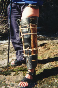
bottles. After breakfast, Michael improvised a splint for
my knee using rope, a piece of my sleeping pad, two slats
cut from a hollow stump, and of course, duct tape. It was
as good as any commercial immobilizer. With a lighter pack,
a trekking pole borrowed from Gail, and much vegetation to
cling to, walking was possible--sort of.
Mary's peg leg (Photo by Mary Powell)
We decided not to just backtrack, but to
head for the second vehicle via a more or less direct cross-country
route, avoiding swamps as much as possible because my splinted
leg caught repeatedly in the denser branches. I don't remember
much of the countryside we crossed Saturday since I was very
 preoccupied
with just staying upright. As evening approached, we found
a grassy clearing that had been a beaver pond at some time.
It made a pleasant campsite. preoccupied
with just staying upright. As evening approached, we found
a grassy clearing that had been a beaver pond at some time.
It made a pleasant campsite.
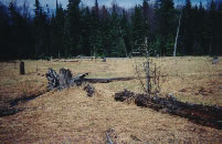
An old, dried-up beaver pond welcomes hikers
south of the West Branch of the Yellow Dog River (Photo
by Mary Powell)
Given time, the body adapts. By Sunday,
I was becoming a bit more proficient at covering ground with
the "peg leg." We headed for Lost Lake, arriving
in the early afternoon. The area had once been a lumber camp
and Michael immediately began to find old cans, broken bottles,
saws, parts of a stove, and a rake imbedded in a tree. After
lunch Mike took a nap while the rest of us decided to explore
the area. We crossed a beaver dam and climbed Pinnacle Rock
for more beautiful vistas--tree tops, distant blue-gray hills,
and the Yellow Dog curving and dropping away below us.
Time passes quickly when you're having
fun. Packing up Monday morning, it didn't seem like it could
be the last day of the trip already. We had only about 1300
meters to go. Mike and Jane would do the navigation, taking
turns counting paces and walking the bearings they had calculated.
They did an excellent job; we came out on the road within
sight of Mike's truck.
Travel through the hardwoods was
relatively easy and I spent some time mulling over what I
had learned--that we are only as strong as our weakest point.
I made a mental list of questions to be answered. What were
the white tubular flowers by the first falls and the pink
ones that looked like miniature rhododendron? What was the
conical creature I saw in the stream on the second day? How
can I get my pack weight down? Is there a way to fix this
knee for future trips? I would definitely be busy with this
"homework" until the next "class."
Read
another journal...
|

 "classes,"
you do the homework: finding answers to the questions posed
by the last trip and preparing for the next one. In my case,
this early May "class" had some difficult lessons.
 The
Yellow Dog River runs through it, dropping sharply enough
in places to create falls. There are numerous small lakes
and wetlands. Last logged around 1910, the tract has some
stands of sizable old timber. Hardwoods, pines, and hemlocks
give way to cedars and other swamp plants in the lowest areas.
 warm,
sunny morning and early afternoon climbing upward. We discovered
a succession of picturesque falls, played in the river at
quieter spots, took pictures, listened to the roar of water
over rock, and contemplated its power.
  the
dark forest beyond.
 preoccupied
with just staying upright. As evening approached, we found
a grassy clearing that had been a beaver pond at some time.
It made a pleasant campsite.